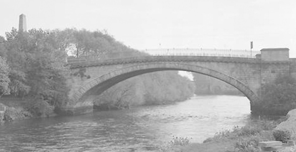

Image credit: Illustration of Islandbridge (1960), Dublin City Library and Archive (DCLA) Vital 7 Repository
South Circular Road
In a letter to the Irish Times in 1908, Mr. W. Henderson, Dublin, noted that it was proposed to rename the road which commenced where the South Circular Road (SCR) stopped at Kilmainham and runs to the Chapelizod Road. Part of this road at the time was called Richmond Hill, part O’Connell Road and the rest appeared unnamed. Some residents suggested that the whole be called Isoldes Road to commemorate the great love of Tristan and Isolde – from whom, it was claimed, Chaplizod gets its name. Isoldes Hill was at the Magazine Fort in the Phoenix Park. However, some time later, the road was included as part of the SCR and given the designation ‘Islandbridge’.
It was characterised as a broad, vertical route commencing at the junction of John’s Road and continuing downhill towards the river Liffey reflecting evidence of the earlier broad highway proposed by the initial planners. It was also the municipal boundary between the wards of Kilmainham to the west and Ushers Quay to the east.
The key building on SCR Islandbridge, and dominating much of the east side of the route was the artillery barracks built by the convicts from various jails, including those from the Richmond Bridewell at the SCR Dolphin’s Barn. Although still called the SCR, the road continued to the north side of the city, just past the crossing of the River Liffey at Sarah bridge. The SCR route terminated at the junction with Conyngham Road with the Phoenix Park providing the link to the North Circular Road.


